Over one thousand miles west of mainland Portugal and one of the few European places where we Brits can visit and have to put our watches BACK an hour, is a cluster of islands – The Azores. One of these is Pico, an island dominated by its central extinct volcano, Ponta do Pico, which stands 7,713 ft above sea level. For the last few months this little island has been the focal point of interest for the planning of the latest in a line of mini expeditions.
Myself and one of my expedition partners, Neil (Kilimanjaro, Via Ferratta`s in The Dolomites) have been pouring over maps of the world since the New Year (sadly Dominic could not make this one having previously completed Kilimanjaro and Finland), eventually settling on Pico, due to the volcano being the highest point in Portugal and the Mid-Atlantic Range, and knowing that we could trek up one day, sleep at the summit and then trek down the following day. To add to the adventure, there is no direct flight, so transfers would be involved and a total of 4,800 miles flown to achieve this. Even before the whisky, it sounded perfect.
This week, the time for adventure arrived and off we set. Saffron Heavy Cake, Beef Jerky and Mackinlay`s Shackleton blended Whisky (recreated from reserves left by the great Shackleton in 1907 at base camp in the Antarctic) were all packed along with the necessary hiking equipment, and off we set.
From here it was not only ourselves that went south. So did our plans for summiting! Having watched the weather, we were aware of a hurricane in the Atlantic. This hurricane was downgraded to a storm, but it was due to hit the island exactly when we wanted to be at the highest point. Then came the message we did not want, it was deemed too dangerous for any of the trails above 2,640ft to be used, in fact even lower down the island was due to be battered with high winds and heavy rain.
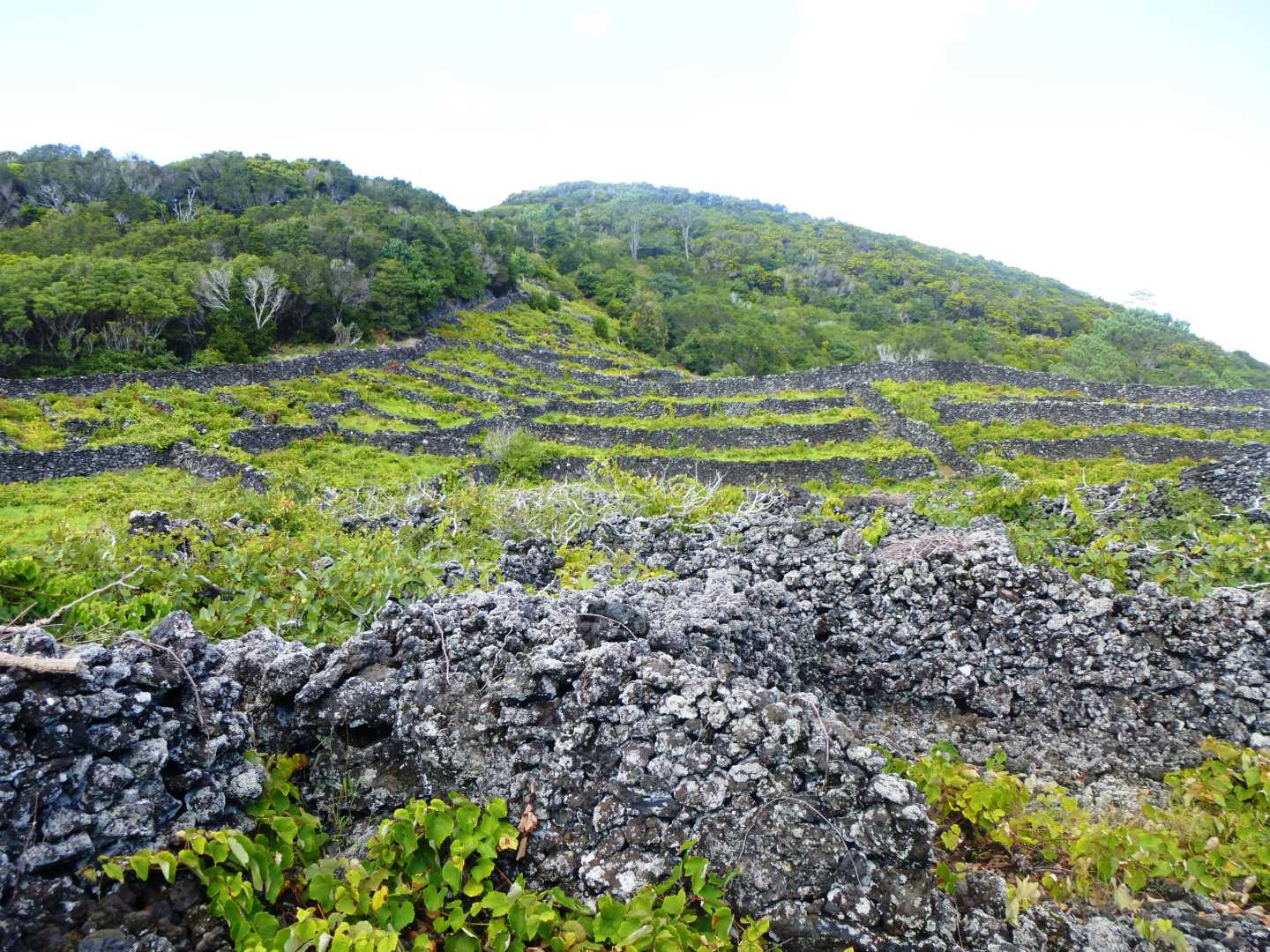
Once on the island it was confirmed that we could not summit, we could not even see the volcano due to storm clouds that had backed up on its south eastern slopes and then spilled over the summit, but we still held out hope. Whilst waiting to see if there was a way around the hurdle that Mother Nature had provided us with, we decided on a short trek of just over 10 miles along the coast and taking in some of the area for which Pico is also famous, the UNESCO-designated historical vineyards between Porto do Calhau and Madalena. A worthwhile trek in itself, and one in which we marvelled at the ingenuity of the first islanders and their method of turning the problems that Mother Nature had dealt them, into advantages. I wonder, could we be so resourceful today?
On the second morning, with storm clouds lying ever lower over the island, humidity in the high 90`s and the possibility of heavy rain being less of a possibility and more of a probability, we set off with a taxi driver who had agreed to drop us inland at 2,785ft. This same driver had agreed to pick us up 4 hours later at a designated point on the coast so that we had someone who knew our rough route and was expecting us.
Within, what would have been the shadow of Ponta do Pico; we left the taxi at Caminho das Lagoas, which is the area of natural lakes situated on the central high plains of the island created by volcanic upheavals and which now serve to provide much of the water for the islanders. In an odd twist of fate, given the weather we were about to experience, many of these lakes are running low of water and one is completely dry!
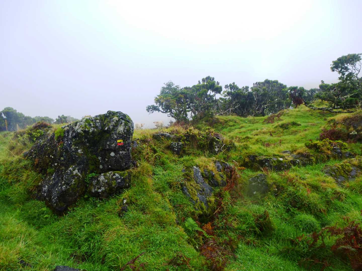
We headed north up the road towards the Lagoa do Capitao (Captain`s Lake), before backtracking a short distance to pick up the path we wanted to follow down towards the north eastern shores of the island. Picking up the trail markers, which are simple yellow and red paint lines which could be on rocks or trees, we headed north west along a volcanic dirt track as it took us along the edge of a secondary small volcanic peak (Cabeco do Piquinho). At this point, we watched as the clouds descended and our already limited view reduced even further, the moisture in the air grew heavier and then came the rain. I have had the good fortune to hike in many fabulous locations but not always in the best of weather, but this rain was rain as I have never experienced before – it was still able to sting through the waterproof layers that were being worn, and as we slowly descended through the plains we had to be sure not to pull our hoods too tightly around us for fear of missing the trail markers.
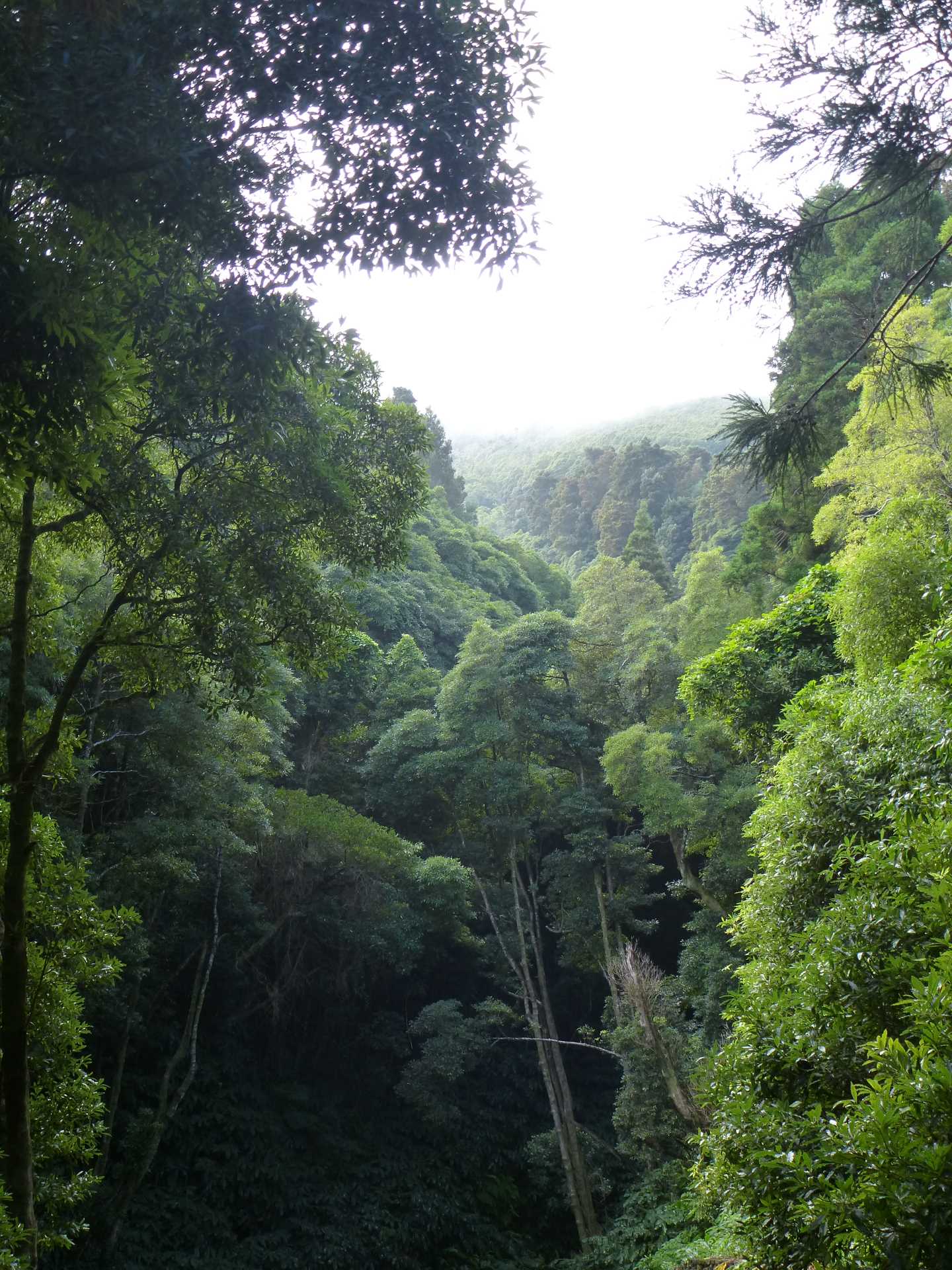
After approximately a mile the trail lead us right, through a gate and then dropped down towards the tree line. At this point the trail changed dramatically. The gentle downward slope became very steep, the soil that had been underfoot was replaced with wet, smooth volcanic rock with occasional coverings of lichen and moss, the moorland fauna was replaced with massive juniper trees and what light we did have was replaced with an atmospheric twilight like light as trees locked limbs above us and around us. Although the middle of the day, the flash was going off automatically on my camera, and had we stepped off the path by any more than 5 meters we may not have found our way back to it. Rather exciting really, although strangely the rain still penetrated where the light couldn`t!
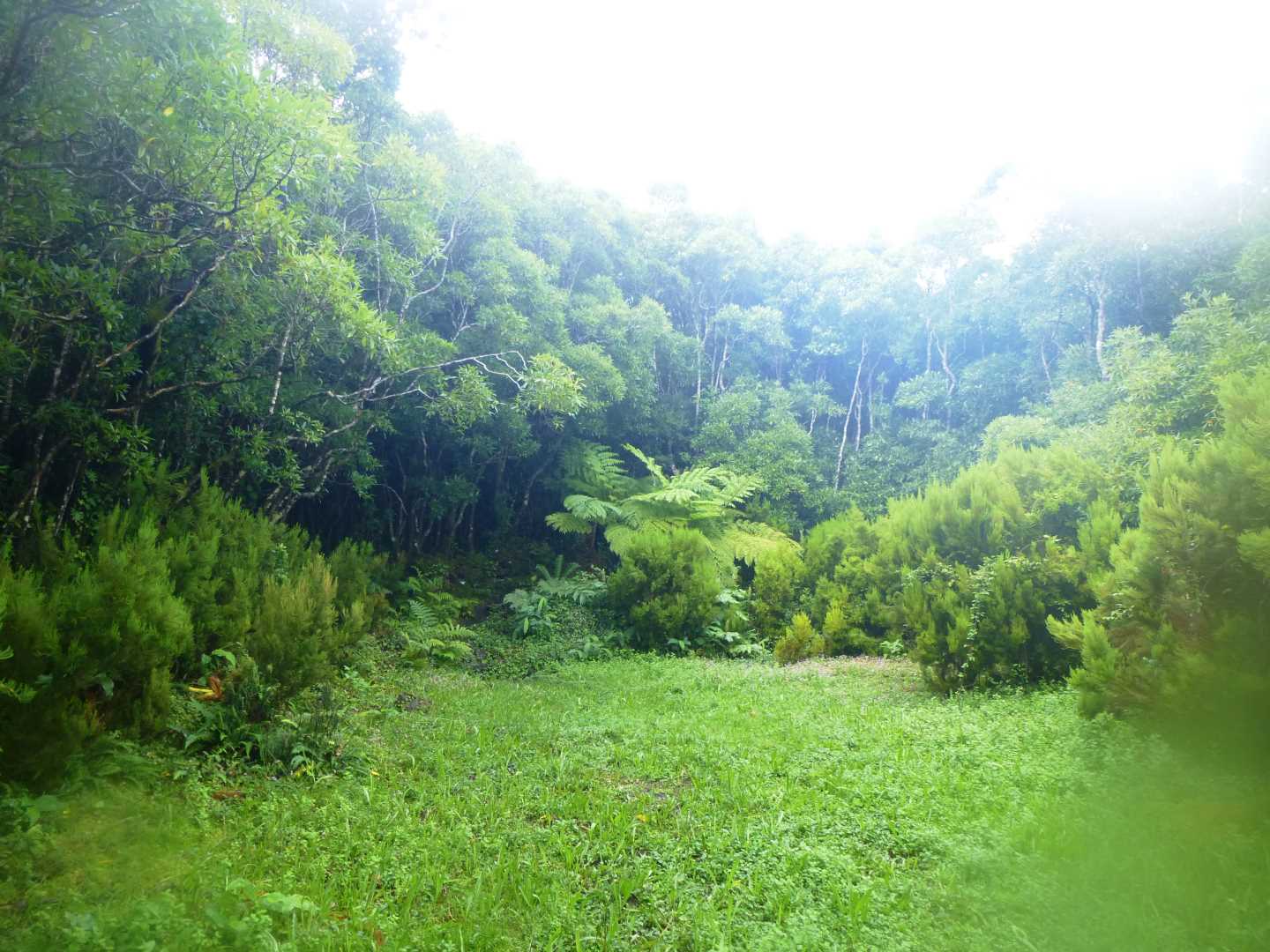
Occasionally, there were breaks in the trees and we would suddenly find ourselves in small open pastures where trees had crashed down, taking others with them, and meadow plants and flowers had rushed to take advantage of the sudden inclusion of sunlight, only for the pastures to disappear from view within a few steps of re-entering the forest, or we would find ourselves looking down a gauge in the tree line created by water rushing off the mountain and thus giving us an idea of how much farther we still had to go.
On one particularly steep section, we were relieved to find a small level area, with which to give our upper thighs a rest from the strain, and we were able to break out the Saffron Heavy Cake and a small swig of whisky with which to warm us up and to toast what was rapidly turning in to a most spectacular hike.
We continued to descend, small step after small step, holding the limbs of trees that have been worn smooth by countless others trekkers, and slowly the gloom started to lift and we noticed more and more ferns of ever bigger proportions and suddenly after 3 miles of descent we found ourselves again on a wide path, with the scents of wild mint in the air, from the rain pummelling the abundance of this plant and releasing their refreshing scent.
As the path then joined the tarmac track, there was the opportunity to head 200 meters back up the side of the mountain to visit the holding tank from the waterfall that would lead down the mountain as the lakes on the plains overspill. This holding tank would then pipe the water to be purified for use by the islanders. Having admired this and stopped a while at the picnic area that is there, we turned about and followed the path back towards the tarmac track as it then wound its way through an ever opening area and the slow appearance of houses, until we found ourselves entering the outskirts of the town that we intended to finish at, that of Sao Roque do Pico, and located the bar where we had arranged to meet our driver.
This trek saved our little expedition. The disappointment of not being able to summit, was replaced with the exhilaration of having completed an excellent hike that may only have been 6 ½ miles, but in testing conditions that made the whole trip worthwhile.
Now all that was needed was to complete the 4,800 miles of this adventure with a stopover in Lisbon, a VERY dodgy accommodation where I was too scared to use the shower, and where did we experience any delays in all the miles travelled and the flights and transfers taken? None other than our very own M5 on the way home. Typical!
What next? Well an evening discussing this expedition (probably with a Shackleton Whisky) and then I suppose we will have to start looking at next year’s little adventure.
Yeghes Da (or for those of you who don`t speak Cornish – Cheers).