Penwith

Bartinney Down

Bartinney Downs Walk

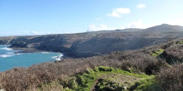
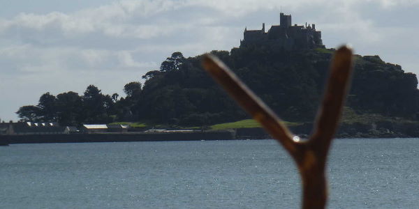
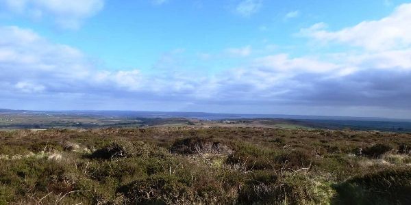
This circular walk, starts in the car park of Britain’s most westerly hill – that of Chapel Carn Brea. It encompasses footpaths, bridleways, roads and open access land. However, although most is easy to get around, the open access land can be difficult to navigate due to being overgrown, or having natural cover if you prefer, which keeps clawing at our trousers and laces. As a walk it really should not take any more than an hour, but the views that are afforded from the summit of Bartinney Downs mean that you cannot rush this walk without doing it an injustice. Both Dad and I are in agreement, that the views at the summit could quite possibly be the best all round views in Cornwall.

OS Explorer Map: 102
Start Ref: 389 283
End Ref: 389 283

Grading: Easy - Medium
Distance: 2.5 miles
Time: 2hrs

St. Ives


This is a coastal walk which allows us the same start and finish point, without having to totally retrace our steps. There are the odd spots of similarity, but with enough difference to add additional interest to the return leg. St. Ives is a well known and beautiful Cornish town, and I will not try to do it the justice that countless more eloquent people have before me, other than to say that before you start or when you finish, linger a while and have a look around.


OS Explorer Map: 102
Start Ref: 5165 4075
End Ref: 5165 4075

Grading: Easy - Medium
Distance: 5 miles
Time: 2.5hrs

Watch Croft

Watch Croft

This is one of the five Marilyn’s in Cornwall (a hill/mountain with a prominence over the surrounding area of at least 150m). Watch Croft has a total height of 252m, and this walk circles the hill taking in Carn Galver and the Men-an-Tol. This area is steeped in history, with Chun Castle on the neighbouring downs and Lanyon Quoit near our halfway mark. A spot well worth visiting.

OS Explorer Map: 102
Start Ref: 4210 3641
End Ref: 4210 3641

Grading: Medium
Distance: 4 miles
Time: 2.5hrs

Castle an Dinas

Castle an Dinas

Having grown up with stories of Cornish Kings and their residences, I was pretty certain that I knew where Castle-an-Dinas was. However, being from mid-Cornwall the dominant Castle-an-Dinas was the one near Roche. The one overlooking Ludgvan was new to me, and a delightful circle walk it is too.


OS Explorer Map: 102
Start Ref: 4908 3418
End Ref: 4908 3418

Grading: Easy
Distance: 3 miles
Time: 2hrs

Godrevy to Hayle

Godrevy to Hayle

This is a gentle walk of about 4 miles with most of the Towans now well grassed and the footpath on not too undulating ground, where you can watch surfers and if you`re lucky – as we were – seals. It affords us lovely views of the sea and long golden beaches, but also keeps us just inland and away from the hordes. For this walk, we will need to do a shuttle run, unless we have enough time to walk back.

OS Explorer Map: 102
Start Ref: 581 432
End Ref: 554 385

Grading: Easy
Distance: 4 miles
Time: 2hrs

Lamorna

Lamorna

This circular walk starts and finishes in the coastal village of Lamorna, and we make our way towards Mousehole via the coastal footpath before returning to Lamorna by an inland footpath. In reality we could say that this walk is based at Kemyel, as we go past several farms of this name as well as cliffs, Points and a Nature Reserve!


OS Explorer Map: 102
Start Ref: 450 241
End Ref: 450 241

Grading: Medium - Hard
Distance: 4 miles
Time: 3hrs

Carn Euny

Carn Euny (Brane)

This walk is a short and circular, and should you wish can easily be extended as it almost meets up with my Bartinney Downs walk. The first half is on footpath and the second half is on a wide bridleway. However, at its midway point is the feature that may well extend our walk by many, many minutes. This is the beautifully maintained ancient settlement of Carn Euny.

OS Explorer Map: 102
Start Ref: 403 284
End Ref: 403 284

Grading: Easy
Distance: 1 miles
Time: 0.5 - 1hrs

Zennor

Zennor


This is a circular walk which takes in both the stunning Cornish coastline, tree lined valleys with babbling rivers, well signposted fields and the spectacular backdrop of Zennor and Trendine Hills.


OS Explorer Map: 102
Start Ref: 454 386
End Ref: 454 386

Grading: Medium
Distance: 7 miles
Time: 3hrs

Cape Cornwall

Cape Cornwall

Cape Cornwall is the only `Cape` on mainland Britain, and until the advent of the Ordinance Survey, was thought to be the most westerly point (a title it lost to its near neighbour Land`s End). Cape Cornwall is also known in Cornish as Pen Kernow, but its actual native name was `Kilgoodh Ust` meaning `goose back of St. Just`.

OS Explorer Map: 102
Start Ref: 353 318
End Ref: 353 318

Grading: Medium
Distance: 3 miles
Time: 2hrs

St. Earth

St. Erth

This is a delightfully easy short walk, with only one slight incline and decline, and for which over half has us walking alongside the soothing sounds of the babbling River Hayle. When I did this walk, I was blessed with more dragonflies than I have seen in one day, a river teaming with brown trout and even a red capped woodpecker. All this and that lovely refreshed feeling that we are left with after being able to cool our feet off after a spot of lunch.

OS Explorer Map: 102
Start Ref: 549 351
End Ref: 549 351

Grading: Easy
Distance: 2 miles
Time: 1.5hrs

Carbis Bay to Marazion

Carbis Bay to Marazion

This walk takes us from the North Coast golden beaches of Carbis Bay, across green fields and down country lanes alongside the impressive Knill's Monument, to the fortified heights of Trencrom Hill past the beautiful church at Ludgvan and through the RSPB Nature Reserve of Marazion Marshes to finish on the South Coast at Marazion, with the added bonus, that at one spot – if we stand in just the right position – we can see St. Michael's Mount, Knill`s Monument and Roger`s Folly! In effect we will be following one of Britain's official Pilgrimage Routes .. The St. Michaels Way which gives us the additional aid of being well signposted.

OS Explorer Map: 102
Start Ref: 527 389
End Ref: 513 311

Grading: Easy/Medium
Distance: 8.5 miles
Time: 5.5hrs