Start Ref: 555 646
End Ref: 555 646
Distance: 3.5 miles
Time: 2.5hrs
This circular walk takes us out on Dartmoor`s southern edge and is an easy, short drive from Plymouth. Cadover Bridge (our starting point) and Shaugh Bridge (our mid way point) are both popular areas for Plymothians to head to on hot days, and picnic and swim by/in the rivers that run under them. However, a short walk away from the bridges will find us on a most gorgeous and secluded walk.
It will take us beside rivers, over footbridges, through gates as well as through woodland and moorland and to the top of the impressive Dewerstone Rock.
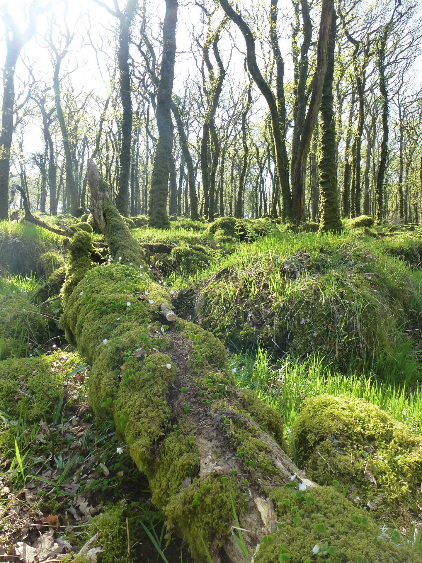
We park our car in the first car park on our right just prior to Cadover Bridge (with an ice cream van on hot days), and head west through the swing gate away from the hoards and janners and immediately into the woods. We are almost immediately presented with a choice of two paths, a lower path along the river edge or a higher path in the trees. Both are lovely and both meet up, so take your pick and enjoy whichever you do. After a short distance following the meandering of the river we step through a broken gate and over a footbridge. Once on the other side of this bridge we are in North Wood and we find that the path (although following the river) moves slightly away from it as the slope on our right becomes steeper.
Through another gate we find a sign announcing that we have now left North Wood and are entering West Down, and it is whilst following the path here that we catch our first glimpse of Dewerstone Rock, an impressive sight at a sheer 745ft (227m) and on which you will occasionally see climbers ascending. Dewer is the local name given for the Devil (thanks for my Devonian friend Glen for this bit of information) whose hell hounds used to chase lost villagers over this rock and to their deaths. Beware!
This, almost Exmoor like rock, although impressive gives us a first inkling as to the hard section of our walk!
Towards the end of West Down, we find a gate with a signpost indicating several various directions. We need to take the finger that leads us to Shaugh Bridge (NOT Shaugh Prior), until we come to another choice of paths. Here we again head towards Shaugh Bridge, but we have the option of a field path or a woodland path. Again both join up after about 60 meters, so the choice is yours.
From here, we are now downhill, and nearing the bottom we pass through another gate next to some ruined circular walls and then we drop down to the car park at Shaugh Bridge. Here is an ideal spot to stop for pasty`s (as my Father and I did) and cool off next to the River Meavy before embarking on the steep hike up through Dewerstone Wood.
To do this we are going to head up the stone laid (if uneven) path following the stream that we have just crossed over as it begins to lead us up. After a short distance the path turns sharp left and then after some 20 meters, we find another smaller path on our right. Now it gets difficult! Follow this path until it again splits left and right, but take the left branch that leads still upwards.
My Father rates an uphill walk by whether or not he could eat and apple and continue walking (and breathing). We are both of the opinion that this is not an apple eating hill ! It is my recommendation that you use the excuse of stopping to assess your altitude gain to re-gather your strength and breath quite frequently (we stopped very frequently).
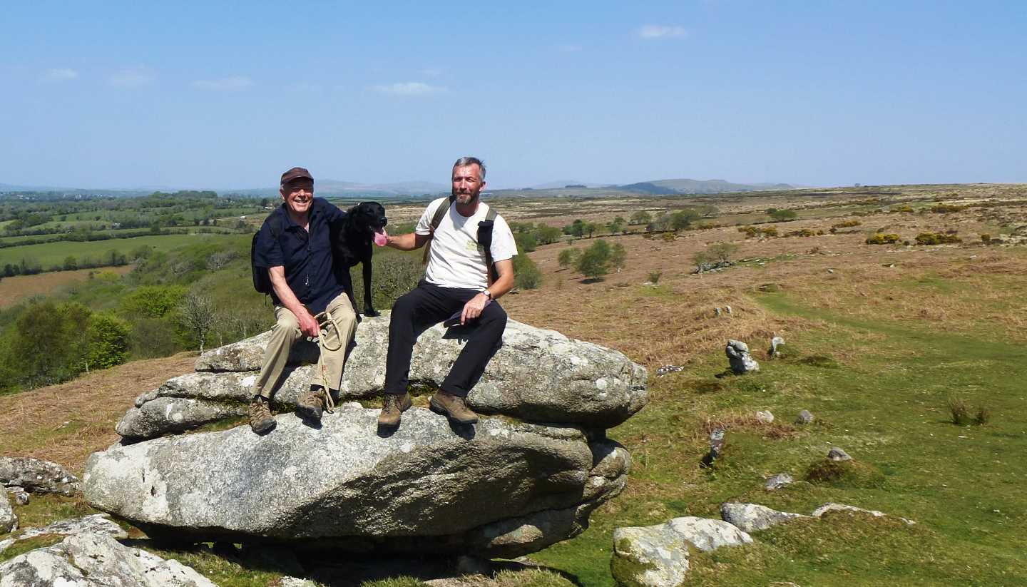
Just when we feel that we have climbed so high that the sky will run out of room, we burst through the trees that cling to life on the slope, step over an old stone wall and find ourselves out on open moorland with a very convenient selection of rocks on which to sit and look out in a South Westerly direction over Plymouth Sound and the Breakwater.
It is from near this spot, that Dad and I were serenaded by our first Cuckoo of 2019 (and on Easter Day as well), so keep your ears open. If not lucky enough to hear the Cuckoo, you may well hear Skylarks, or witness Buzzards soaring and moorland ponies grazing.
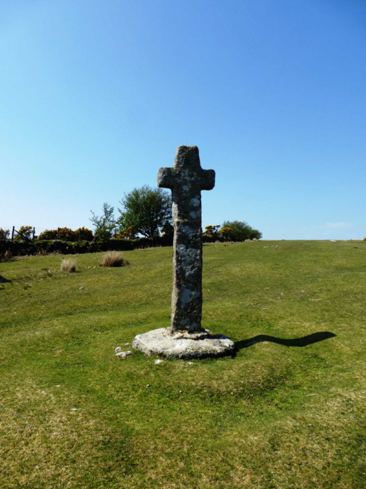
We are now on relatively easy walking moorland (called Wigford Down) and can follow the well trodden path along the higher edge of the tree line (on our right) until we pick up the old stone walls of Lower Cadworthy Farm. These walls we are going to keep to our right as we employ the navigational aid of hand railing (following a feature) for the next ¾ mile until we find ourselves standing by an old Restored Cross and now within sight of Cadover Bridge.
It is now a short distance down to the road and over the bridge, to return to our car.
I hope that you enjoy this walk as much as Dad and I (and Moss, my parents Black Labrador) did, and I look forward to posting another walk soon.