Start Ref: 921 447
End Ref: 921 447
Distance: 4.5 miles
Time: 2hrs
This gentle valley walk takes us along the broad and flat silted bed of the old (wider) River Fal, up towards an unusual pub before heading us up to great views and then heading back for a mile of road walking before picking up the valley floor to return to our start point.
A note.. This walk has around a mile of road walking (not something I am inclined to include, but necessary for this walk to be circular). This busy road connects Grampound and Tregony, so care must be taken. There is also, due to the closeness of the river and this effectively being a flood plain, some rather muddy and boggy spots. Here I favour sacrificing the youngest child as a stepping stone (although when I last did this walk I had as company my eldest – but she worked just as well!).
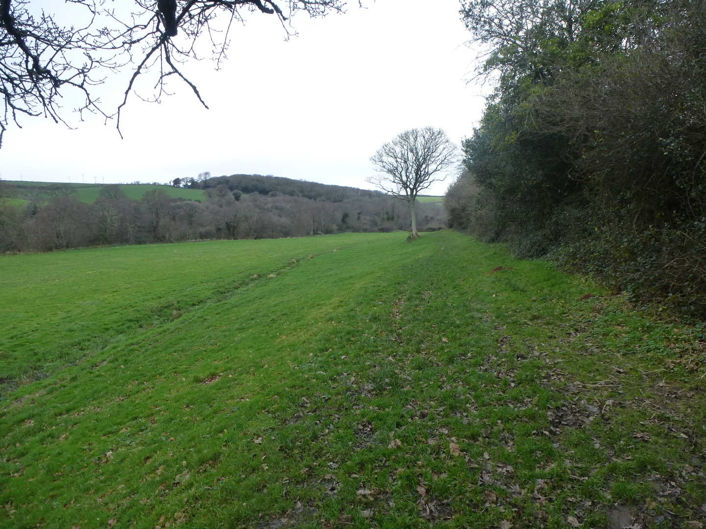
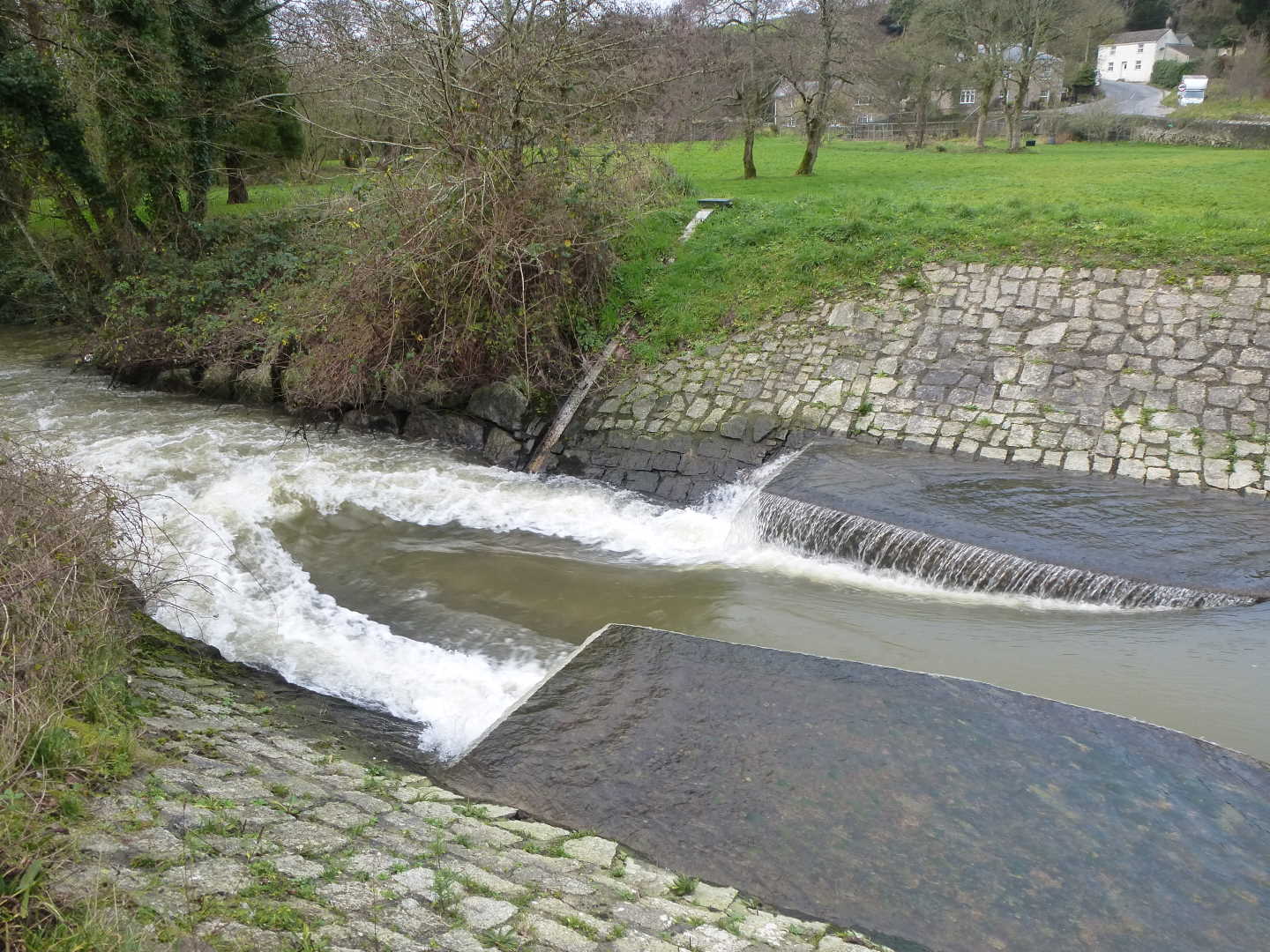
We started this walk in the little car park by the bridge at the lower end of Tregony, which is right next to the weir, and situated alongside the River Fal. The footpath starts on the bridge, but on the other side of the road, so care needs to be taken crossing over to get to this stile, however, once over we find ourselves immediately on `The Moor` or the wide flat flood plain. Keeping to the left hand side of The Moor we follow the river upstream until we find ourselves being directed right away from the small enclosure saying Private. We only head right for a short distance, as we cross a little stream and are then confronted with two options. Left or right. We will return via the right hand option, so we need to take the left hand path which leads up a path but quickly descends down again (apparently into the Private land! – but do not worry, you are on the right path). Now hugging the right hand side of The Moor we wander over two field areas before finding ourselves in the trees at the bottom of Wallis Downs.
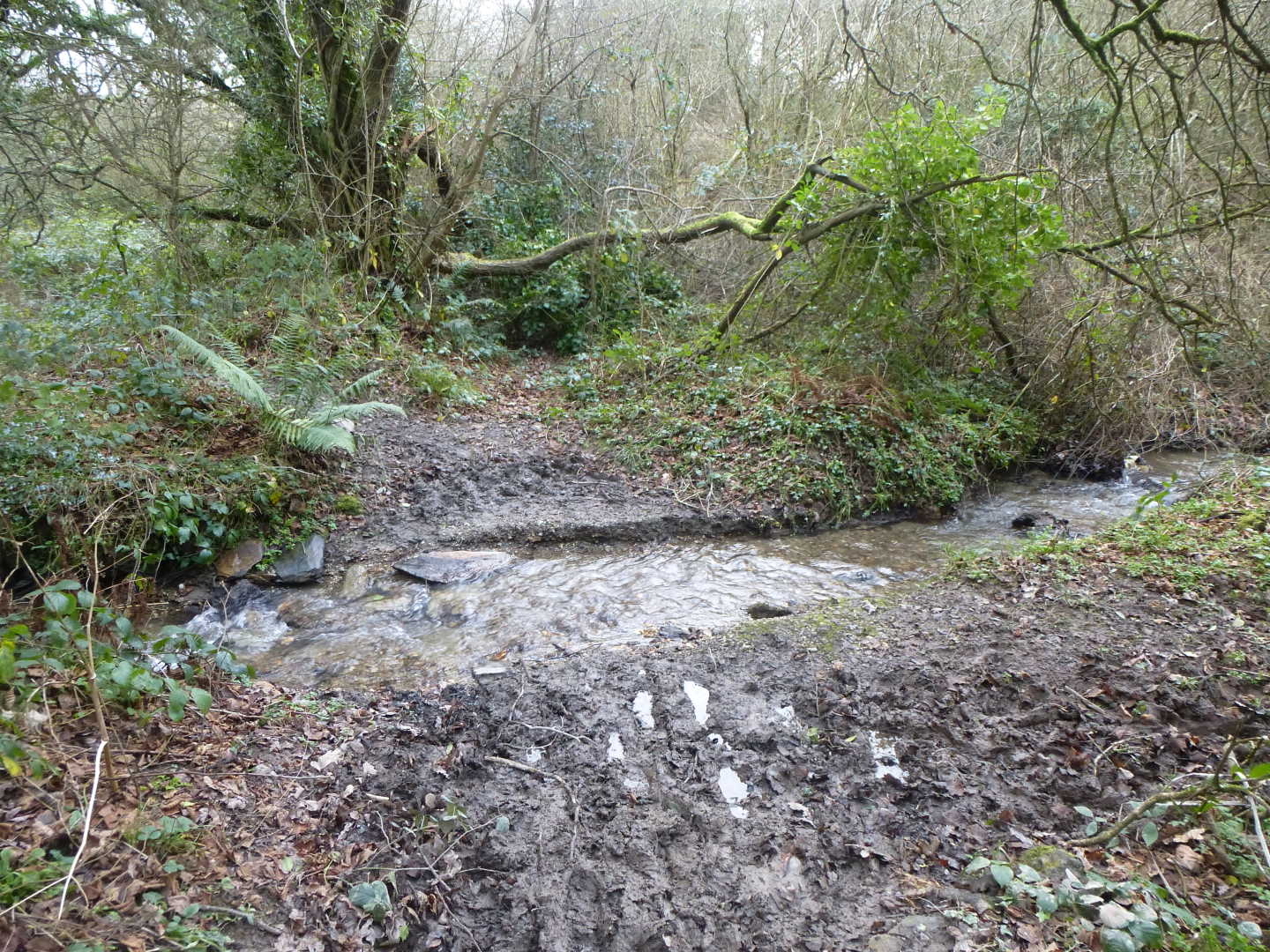
Once in the trees we have to turn almost immediately left and across another stream and then into a rather boggy area (it is here that I sacrificed Alice – say hello to her when you do this walk!). This section of the walk gives us lovely glimpses of the river, with some areas you can get really close. NOTE: Rivers can be fast flowing and dangerous, and this one has lots of submerged hazards. On a serious note, do not go in.
We emerge from the woods and step over an electric fence to find ourselves back on the wide flood plain (which when I last did it, was partially flooded) so we need to hug the river bank on our left. Shortly on our left we will see a footbridge – not for us – crossing the river, but we shall continue straight on up towards the gate in the distance. At this gate (again boggy before) we find a stile and we can hop over to the road.
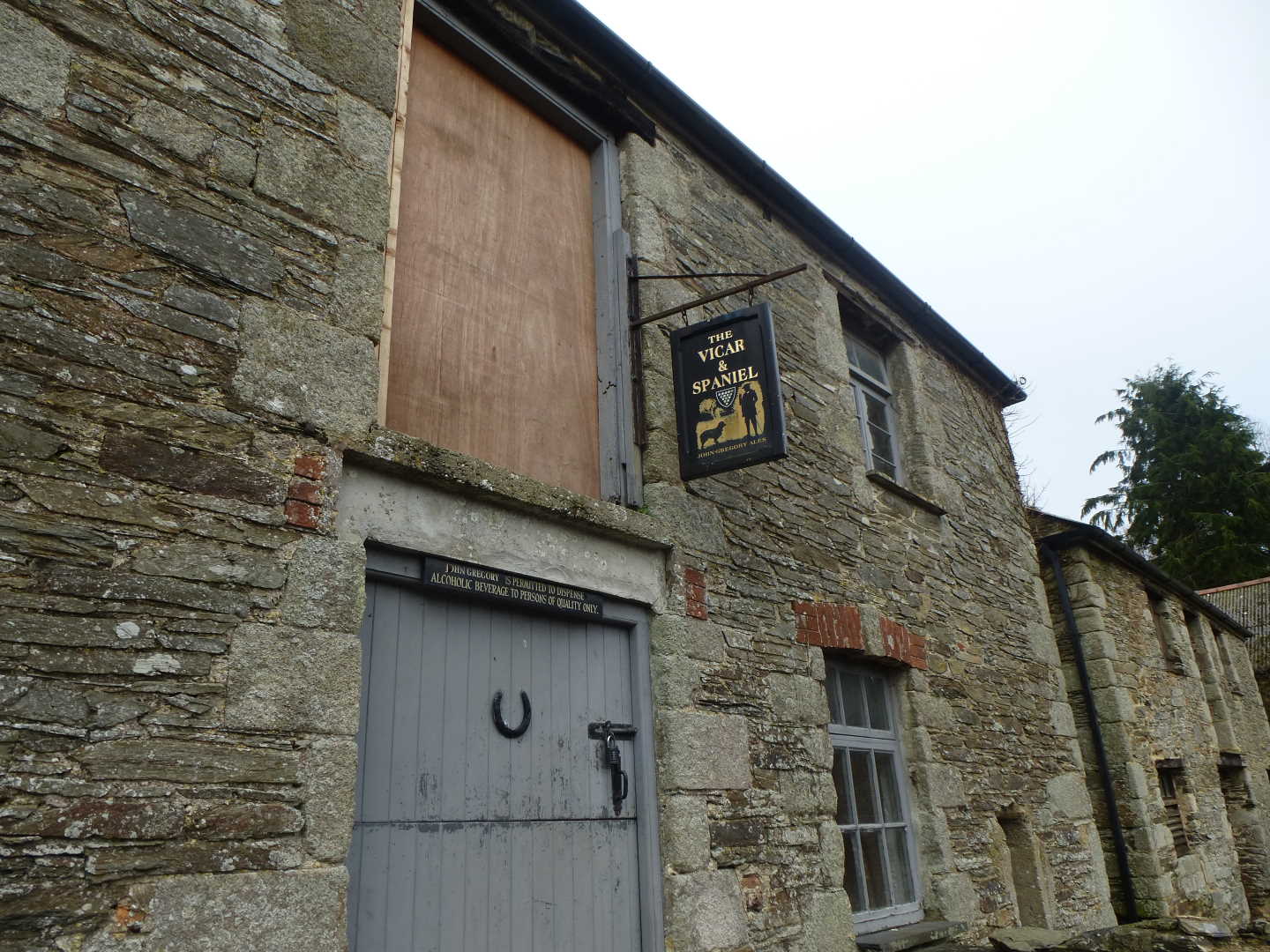
We are going to turn right here, and follow the road/bridleway up the hill enjoying views out over St. Austell and even catching a glimpse of Creed Church. HOWEVER, before turning right, turn left over the bridge and have a look at the barns on the other side of the road. If you look closely you will see that one of them is licensed and called the Vicar & Spaniel. It only opens on specific occasions and for a specific reason and it serves beverages to Persons of Quality Only (I can boast that I have drunk in this fine establishment).
Returning to the walk, we rise up to the road, where we turn right, still rising until we meet the next T-Junction. Here we are now on the busy Grampound to Tregony road, so dogs and children need to be kept on leads. Single file is imperative as there is no pavement, although the verge is wide enough (in places) to walk on. After around a mile we find ourselves at The Roseland School and the pavement starts as we now follow down to St. Cuby`s Church. At the Church we turn right following its lower edge until we can bear right down a little road alongside the playing field. Following this path down we arrive at the Police Station (yes, there is one in Tregony), and here we follow the footpath signs around to the right and then left as we walk down hill on a narrow path until we find ourselves at a kissing gate on our right with the path also continuing to our left.
We will pass (right) through this gate and find that we are back at the point of the walk where we had a choice of directions just over an hour ago, and now we are going to head left over the little stream and then head towards the river, which we will now keep on our right until we come to the stile which will lead us up to the main bridge, and with care, back to the car park.
I hope that you enjoy this walk, and that those of you that were not used as stepping stones were also not too muddy by the end.