Start Ref: 767 587
End Ref: 767 587
Distance: 6.5 miles
Time: 3hrs
This gentle coastal and beach side walk takes us from the village of Holywell, out around Penhale Point and around the sealed off military area of Penhale Camp and on to Perranporth, where we have the advantage of several refreshment spots before the return leg of our walk.
It has also given me yet another chance to see the Cornish National Bird – that of the Chough. This is (to date) the farthest north that I have seen one, but given the number that I have seen this year alone in a variety of different locations on both the north and south coast (all locations religiously noted down on my trusted OS maps), I have no doubt that I shall continue to see them around our coast. A true success story of natural return, re-introduction by humans and the South West Coast Path and farmers creating the perfect feeding and nesting grounds.
We left our car in the National Trust car park at Holywell and headed straight across the road towards the beach. Here we find one of the lovely slate slab signposts that either directed us towards the beach or off slightly to our left and on towards Penhale Point. We took the left branch and as the shrub lined path turned left to go through a little gate, we found ourselves being reminded to keep to the path as we are bordering military land – plus there are mine shafts which we do not want to fall in to (keep dogs on a lead).
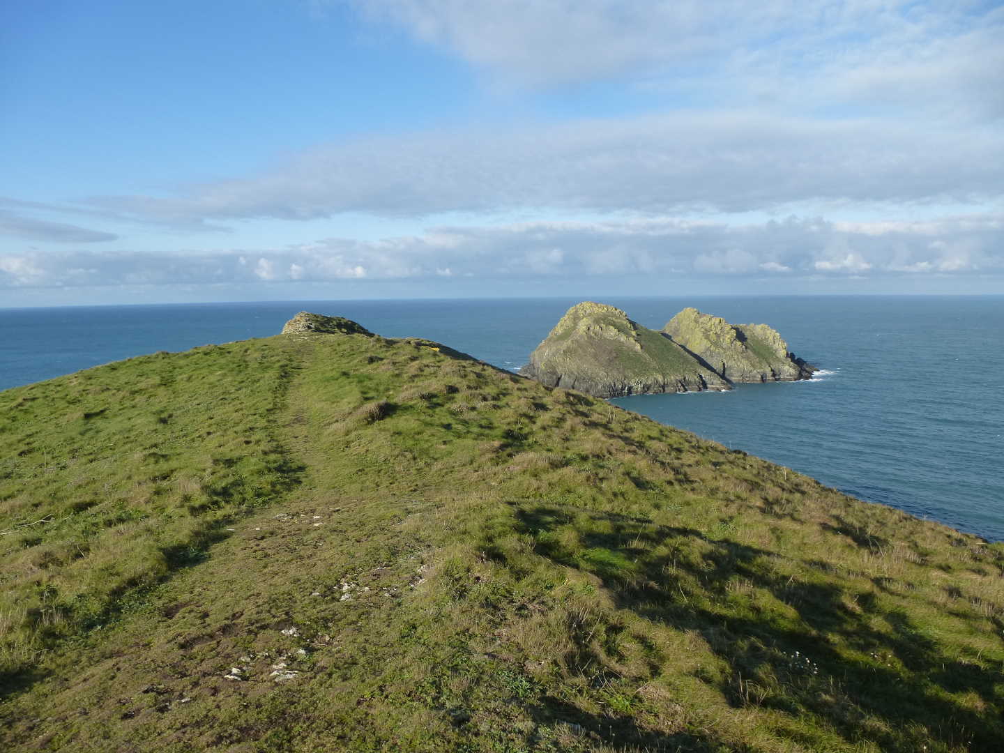
As we pass through another little gate we see a sign informing us that the grazing ponies have been removed. This is because well-wishers have been feeding them and this changes their character and encourages these wild ponies to get too close to humans (or rather us to them), and this can become a safety issue. Ahead of us we see Carter`s or Gull Rocks and as we reach Penhale Point, we can walk out to see them closer – BEWARE, the southern side of Penhale Point is very (yes very) sheer. Returning from the Point, we come to the weird looking hoops that are fenced off, with a nice sign informing us of death by electrocution (but it is alright as they are producing Non-Ionizing Radiation).
Following the well made up path we carry on, quite close to the edge of many little Zawns, until we find Penhale Army Camp on our left. There is something rather emotional about this mixture of nearly 70`s buildings and the more evocative Nissan Huts that scatter the site. However, from here to Hoblyn`s Cove (where you join a more substantial track that bears right passing by two houses) keep your eyes peeled. This is where I saw the Chough.
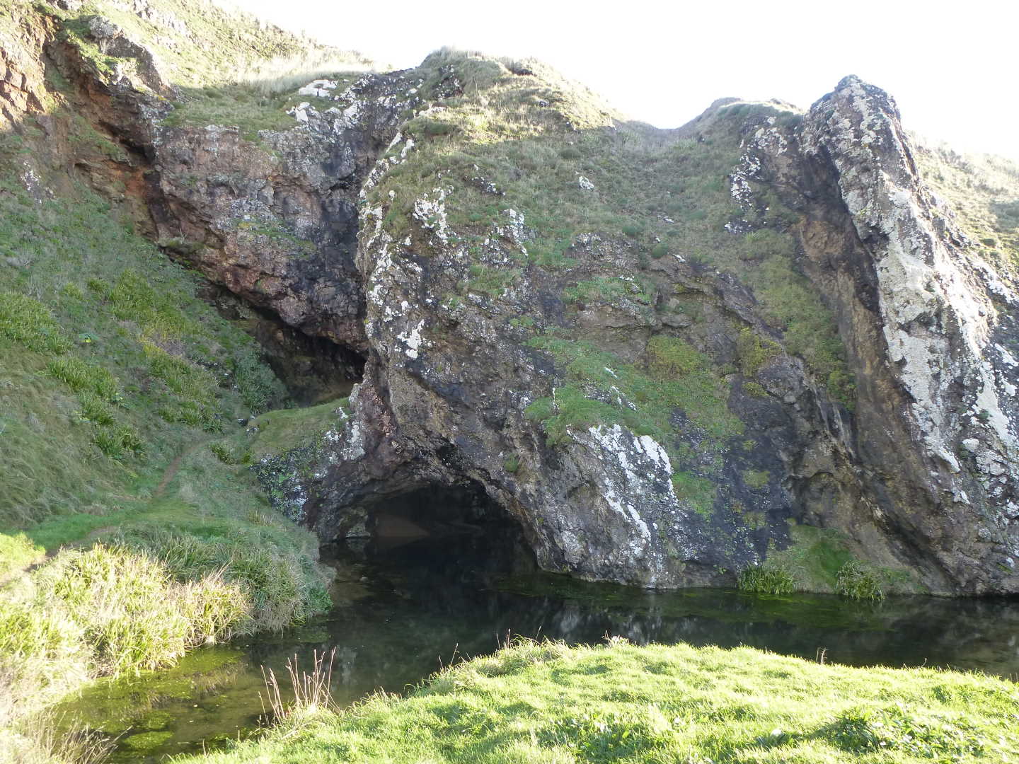
We continue walking on out towards Ligger Point now, always keeping these houses on our left as we loop around them, and coming around Ligger Point we find ourselves on the sloping sides of this point with great views out and over Perran Beach. We continue to follow the path through a gate and then over a stile, before beginning to head down and picking up the end of a concrete path. Following this path down and it brings us to the sunken cave with the two gated off mine entrances. Quite a spot for a picnic.
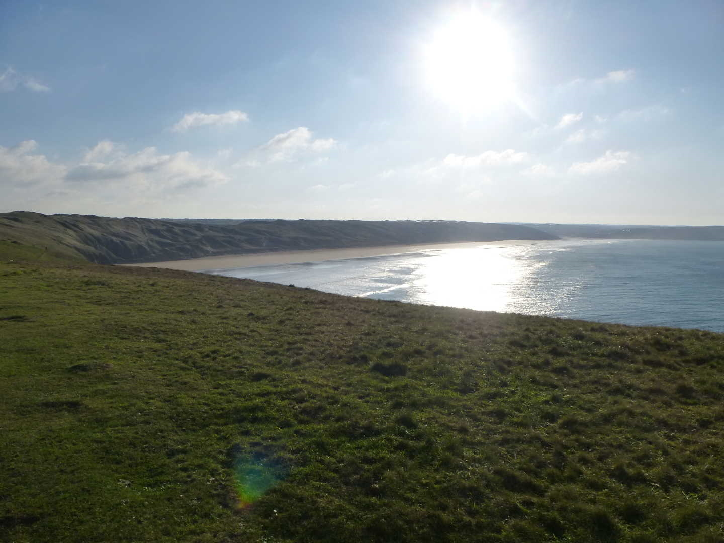
Now we step over the brow and onto the beach itself. This good 2 mile expanse of golden sand is a great flat walk on any day, but after a storm, when the weather has turned crisp and the sun is out, but the temperature is still low – it`s a beauty.
My daughter and I ignored the coastal path now (although we will return by it) and walked the length of the beach until we came to a rather famous pub on the beach and partook of two large hot chocolates as our reward for walking here!
Refreshed, we started our return leg. This time, as the rocky outcrops start as the dunes behind the pub finish, we find a set of steps in the rocks. Taking these we find ourselves now walking above the beach, and we see a memorial bench to Winston Grahame (of Wind in the Willows fame), and we carry on following this narrow footpath high above the beach but bordering the dunes, until we come to a spilt in the path. The right hand direction will take us up to the holiday camp, where the left branch takes us down some winding steps back to the beach (at the base, we see the foundations of a building, which as a child I remember buying ice creams from). Here we turn right and cross over the fresh water that is coming out of the rocks – it is easier to cross either right by the cliffs or walk down the beach towards the sea where it shallows right out.
Continuing along the beach we return to the sunken cave and now have the task of walking up the hill to pick up the path back along to Ligger Point. As we round the point, we have the strange sensation of being able to see the village of Holywell directly in front of us, but have to keep bearing away from it to get there! Back around Penhale Point and we again get a view of Holywell Bay and Beach, which in itself is worth walking (see my walk on the Kelsey Head).
Again, there are a couple of pubs in Holywell if you need a refreshment before heading home (obviously drink responsibly!).
I hope that you enjoy this walk, part of which is a favourite of many on Boxing Day / News Year Day.